


•Notícia


Experts from the Institute of Geomatics estimate that the land at L’Aquila has moved 18 cm
A study undertaken by the Institute of Geomatics—a public research institute founded by the Generalitat (Government of Catalonia) and the UPC—a coseismic deformation of up to 18 cm has occurred at L’Aquila (Italy) due to the recent earthquake.


According to the data analysis undertaken by the Institute of Geomatics—a public research institute founded by the Generalitat (Government of Catalonia) and the Universitat Politècnica de Catalunya (UPC)— a coseismic deformation of up to 18 cm has occurred at L’Aquila (Italy) due to the recent earthquake.
The Institute of Geomatics’s results contribute to the study of this earthquake. They were obtained using a well-know satellite remote sensing technique called interferometric synthetic aperture radar (InSAR), which can be used in a wide range of applications.
InSAR is a useful remote sensing technique for monitoring surface deformations. It has been used to study the dynamics of glaciers, earthquakes, volcanoes, mining activities, civil engineering works, landslides and deformations due to water extraction.
The results of this study were obtained using InSAR data from the ROSTIR sensor, which is mounted on the European Space Agency’s Envisat satellite. Specifically, two InSAR images were used: one that was taken before the earthquake (1 February 2009) and one that was taken after it (12 April 2009). The data were compiled using DIAPASON software and analytical tools developed by the Institute of Geomatics.
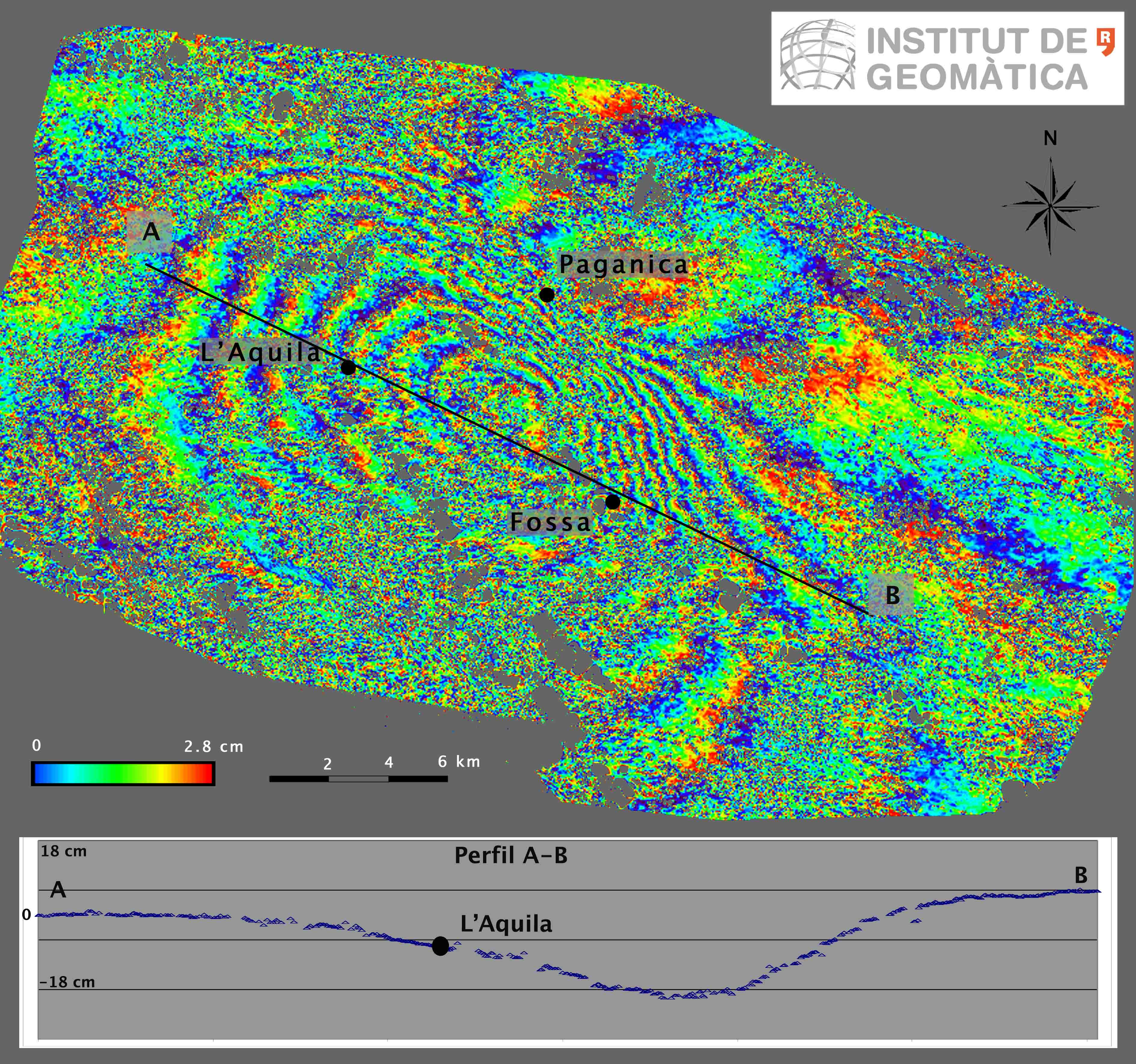 Map of coseismic deformations caused by the L’Aquila earthquake, based on InSAR data from the European Space Agency’s ASAR-Envisat sensor. The displacements can be seen in the deformation map shown in Figure 1, in which each colour band corresponds to a displacement of 2.8 cm. If we start from an area that was not affected by the deformation (see the area to the left of the image), we can count approximately 6-7 bands (spanning approximately 18 cm) before reaching the area of maximum deformation.
Segueix-nos a Twitter